Atlas United grades the risk a property carries. AtlasCast forecasts the storm that's coming for it — 10 storm types, per address, 16 days out, refreshed four times a day. Built entirely on U.S. federal weather models, so decision-makers see the threat with time to act.
AtlasCast turns federal weather models into an address-level warning the teams responsible for people, property, and infrastructure can act on — days before impact.
Pre-position crews and shelters, alert vulnerable facilities — schools, hospitals, nursing homes — by exact address, and buy evacuation lead time before impact.
See which addresses on the book face incoming severe weather, warn policyholders to mitigate, and pre-stage catastrophe response, reserves, and claims.
Pre-stage line crews ahead of wind and ice, harden the at-risk grid segments, trigger automated hail-stow for solar assets, and cut outage minutes.
Mitigation planning, hazard mapping, and resilience for Federal, State, and Local agencies — auditable, citable, first-party federal intelligence.
Reroute fleets, protect cargo, and reschedule operations around severe weather with per-corridor lead time instead of last-minute scrambles.
Protect crops and livestock ahead of freeze, hail, and flash flooding — with a forward forecast tied to the specific fields at risk.
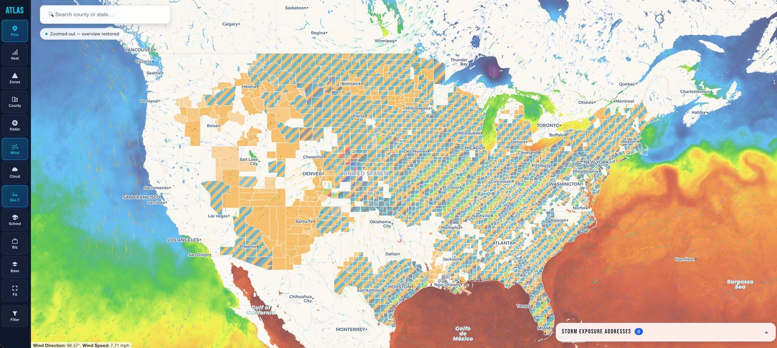
Each U.S. address is classified for the hazard actually forecast to reach it — from spring supercells to winter ice, all from one engine, all from federal data.
Four times a day, AtlasCast pulls the government's own weather models and turns them into a forecast for every address in the country.
The same federal weather models the National Weather Service runs — ensemble, high-resolution, and live radar. All first-party government data.
The storm-environment signals for every point on the grid are derived and scored for each of the ten hazard types.
Each storm is projected across the forecast hours with a confidence cone that widens the further out it looks.
The forecast is matched to the 282.9M U.S. addresses under it — who is actually in the path, and how likely.
Every one of 282.9M U.S. addresses — not a county, not a ZIP, not a radar tile.
A 16-day forecast of what's coming — not a static grade of what a property is.
Built entirely on U.S. government weather models. No third-party feeds, no reselling.
Severe, tropical, and winter hazards from a single engine, refreshed around the clock.
A forecast is a probability, not a promise — AtlasCast flags the threat with lead time to act.
Most peril data hands you a color on a map. AtlasCast hands you the physics behind the call — and a signature proving the answer wasn't altered after it left our servers.
When an address is flagged, AtlasCast shows the actual meteorology that triggered it — CAPE, storm-relative helicity, precipitable water, fire-weather index — not just a grade. Present whenever the qualifying weather is real for that forecast cycle, so the reason is always tied to genuine atmospheric data, never invented after the fact.
Every AtlasCast forecast carries its own Ed25519 signature and content hash, on its own signing key — separate from the rest of the platform. Recompute the hash and it either matches the response or it doesn't. No ambiguity, no vendor black box.
Launch the live national map, or request access to the AtlasCast API for your addresses.